
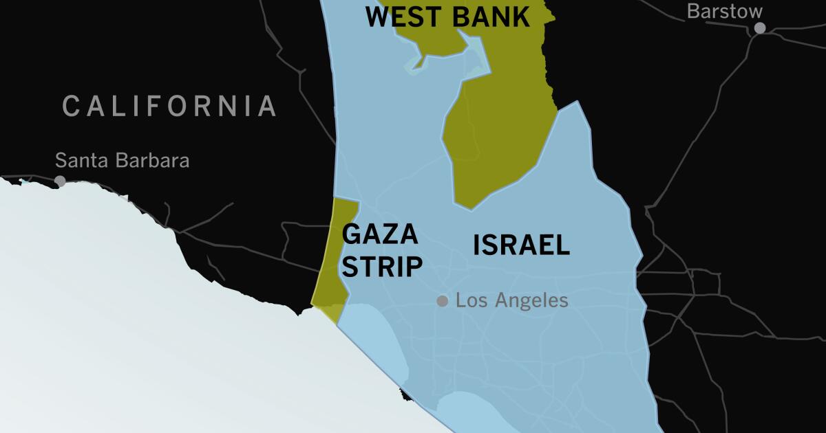
If you haven’t visited Israel or the Gaza Strip or spent much time thinking about their geography, it can be hard to understand how compact they are and how violence in one spot can feel immediate and personal throughout the area.
Maps of the region often look like this: Israel fills the frame. To people who are used to looking at maps of the United States, there seems to be plenty of space between major cities.
Likewise, about 6 hours to drive from the West Coast of Washington to the eastern border. So Israel is about an tall as Washington State is wide.
So it’s like if a fascist group seized control of Vancouver island and started lobbing rockets while Hezbo-Idaho invades from the east
Potato rockets from Idaho, yes. Also, Northern Idaho is practically a terrorist state anyway with its history of KKK enclave and, well, general elected officials.